Forecast for the Provo Area Mountains

Drew Hardesty
Issued by Drew Hardesty on
Sunday morning, February 24, 2019
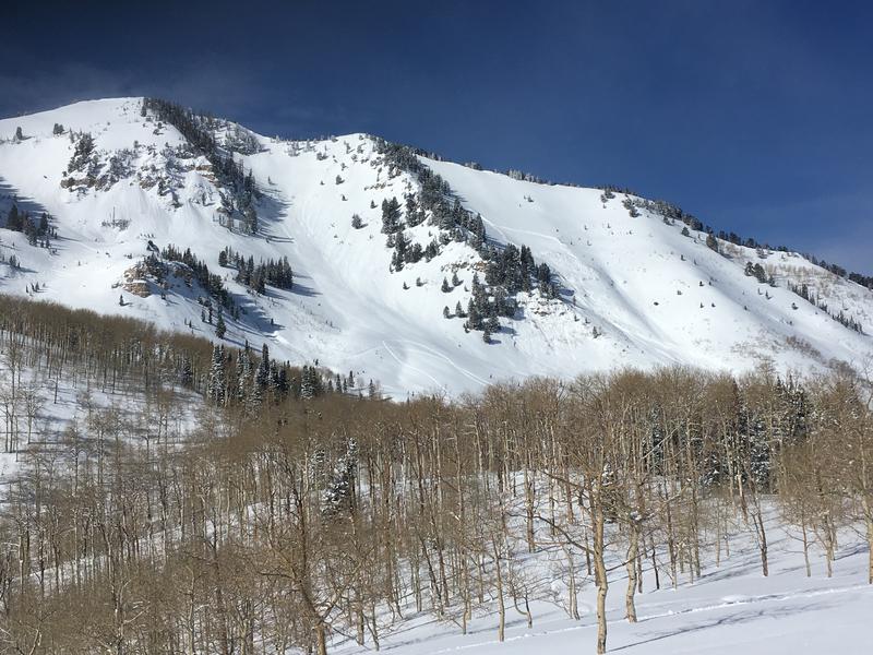
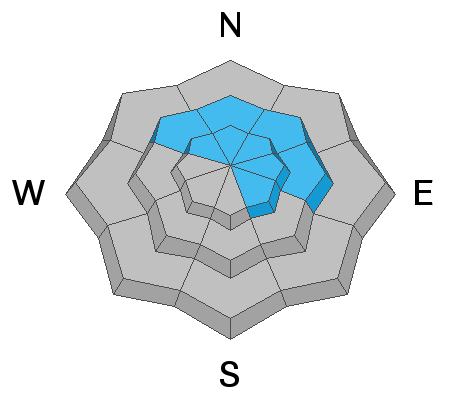
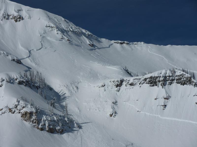
Areas of CONSIDERABLE danger remain in the upper elevations of the Provo mountains. The most widespread avalanche issue will be developing wind drifts at the mid and upper elevations. Large and destructive avalanches may also be triggered by heavy loading events on northwest to southeast facing slopes. Cornices should be avoided. Wet loose slides are possible with daytime warming.
Low
Moderate
Considerable
High
Extreme
Learn how to read the forecast here
Special Announcements
Weather and Snow
Skies are partly cloudy with mountain temperatures in the teens. Winds are westerly, blowing 10-15mph but 20-25mph in the more exposed locations. It's been a pretty good run this winter and many snow stations across the state are well above average. Snow depths sit at 90-100"+ and the Timp Divide snotel site is below. The blue line is this year. A statewide map can be found here.
We'll see increasing clouds tonight and perhaps a few flurries to a couple inches of snow this week with a storm passing by to the north. The storm will favor the Logan and to some extent the Ogden area mountains.
Temps today will reach the upper teens at 10,000' and the upper 20s at 8000'. Winds will be southwesterly at 20mph.
Recent Avalanches
One possibly snowmobile triggered avalanche reported from Friday in the UFO Bowls north of Aspen Grove. These are steep, east to northeast facing avalanche prone paths at 9500-10,000'. (pc: Barber). Many other large avalanches have occurred in the past week in the high elevations, particularly along the Cascade ridgeline. We have fewer reports from Timpanogos and Box Elder. The Mill Canyon Peak area also had numerous avalanches in the past week as well. One can find photos in the menu above.
Ad
Avalanche Problem #1
Wind Drifted Snow
Type
Location
Likelihood
Size
Description
Be on the lookout for recent and developing shallow wind drifts along the higher elevations today. The low density snow will easily move with the slowly increasing westerlies today and tomorrow. These drifts may be up to a foot+ deep and more pronounced on steep north to east to south facing slopes above 8000'. Due to terrain channeling, pockety drifts may be found in the mid-elevation of all aspects. Take note that it may be possible for some drifts to be triggered remotely (at a distance). Cornices remain unwieldy and should be treated with suspicion.
Avalanche Problem #2
Persistent Weak Layer
Type
Location
Likelihood
Size
Description
Assessing the snowpack in the Provo area mountains in avalanche terrain at mid and upper elevations on NW, N, NE, E aspects (and upper elevation SE) is difficult. Recent natural avalanches have broken at the ground. With this type of avalanche it is very hard to assess what the likelihood of triggering one is. All we really know is that these slides have been MASSIVE and would be deadly to be caught in. The only mitigation strategy we have is to avoid avalanche terrain for now.
With such large cornices looming over many slopes, I'd would avoid run out zones. Cornices can break on their own and trigger more massive slides that could run down on top of you.
Photo: Zoomed in view of the natural avalanche that was spotted earlier this week.
Additional Information
So how awesome has February been? One way to see is looking at how much water was contained in the snow. Mark created this graph, and a whole blog with more details HERE.
The accident reports for the four avalanche fatalities are all finalized with some first-hand accounts and worth reading. We all have something to learn so that we can get home safely to our loved ones. List of all accidents found HERE.
General Announcements
This information does not apply to developed ski areas or highways where avalanche control is normally done. This forecast is from the U.S.D.A. Forest Service, which is solely responsible for its content. This forecast describes general avalanche conditions and local variations always occur.