Forecast for the Provo Area Mountains

Drew Hardesty
Issued by Drew Hardesty on
Saturday morning, February 23, 2019
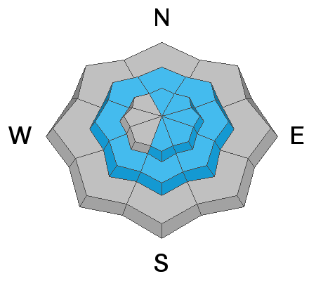
Areas of CONSIDERABLE danger remain in the upper elevations of the Provo mountains. The most widespread avalanche issue will be developing wind drifts at the mid and upper elevations. Large and destructive avalanches may also be triggered by heavy loading events on northwest to southeast facing slopes. Cornices should be avoided. Wet loose slides are possible with daytime warming.
Low
Moderate
Considerable
High
Extreme
Learn how to read the forecast here
Special Announcements
Weather and Snow
Skies hold just a few clouds and a slowly setting and waning gibbous moon. It's a beautiful morning.
Mountain temperatures are in the single digits. Winds are west to northwest blowing 10-15mph with gusts to 30. The westerlies along the highest peaks and ridgelines are blowing 30-35mph with gusts to 45.
Snow depths are 85-100" in the mid and upper elevations. Skiing and riding conditions are excellent but you'll need to look for sun and wind sheltered terrain today.

A moist westerly flow will begin to set up over the next week with some light precipitation (and a bit more wind) in the Ogden and Logan area mountains. Mountain temperatures will slowly warm to the upper 20s along the upper ridgelines by mid-week. For today, we'll have just partly cloudy skies with temps in the low teens at 10,000' and near 20°F at 8500'. The west winds will slowly increase over the course of the day, blowing 20-25mph by late afternoon.
Recent Avalanches
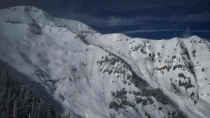
A very large natural avalanche that released in the Provo area mountains this week, after the storm was over. This slide was 5-9' feet deep and up to 2500' feet wide, running 3,000' vertical feet to the valley floor. (PC: UDOT)
Ad
Avalanche Problem #1
Wind Drifted Snow
Type
Location
Likelihood
Size
Description
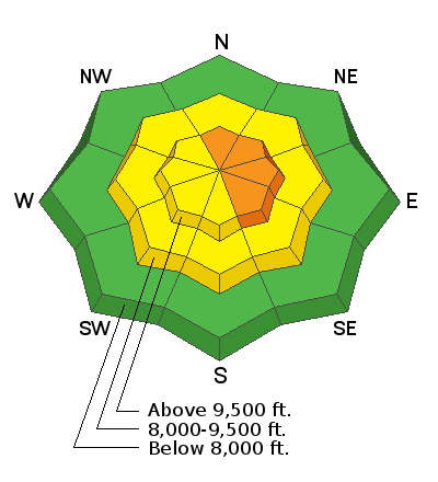
Be on the lookout for developing shallow wind drifts along the higher elevations today. The low density snow will easily move with the slowly increasing westerlies today and tomorrow. These drifts may be up to a foot deep and more pronounced on steep north to east to south facing slopes above 9500'. Due to terrain channeling, pockety drifts may be found in the mid-elevations of all aspects. Take note that it may be possible for some drifts to be triggered remotely (at a distance).
Stubborn drifts may be found on westerly aspects from Thursday's easterly winds.
Avalanche Problem #2
Persistent Weak Layer
Type
Location
Likelihood
Size
Description
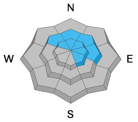
Assessing the snowpack in the Provo area mountains in avalanche terrain at mid and upper elevations on NW, N, NE, E aspects (and upper elevation SE) is difficult. Recent natural avalanches have broken at the ground. With this type of avalanche it is very hard to assess what the likelihood of triggering one is. All we really know is that these slides have been MASSIVE and would be deadly to be caught in. The only mitigation strategy we have is to avoid avalanche terrain for now.
With such large cornices looming over many slopes, I'd would avoid run out zones. Cornices can break on their own and trigger more massive slides that could run down on top of you.
Photo: Zoomed in view of the natural avalanche that was spotted earlier this week.
Additional Information
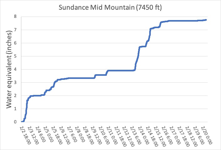
So how awesome has February been? One way to see is looking at how much water was contained in the snow. Mark created this graph, and a whole blog with more details HERE.
The accident reports for the four avalanche fatalities are all finalized with some first-hand accounts and worth reading. We all have something to learn so that we can get home safely to our loved ones. List of all accidents found HERE.
General Announcements
This information does not apply to developed ski areas or highways where avalanche control is normally done. This forecast is from the U.S.D.A. Forest Service, which is solely responsible for its content. This forecast describes general avalanche conditions and local variations always occur.