The avalanche danger starts out LOW this morning, rising to MODERATE during the afternoon due to warming of the snowpack. In general, wet avalanche activity is managed most effectively by timing - once the snow surface becomes wet and sloppy, it is time to move to a shadier aspect. Watch for signs of wet, loose snow including rollerballs and sluffing in the wet snow.
However, avalanche concerns in the spring can become complicated, and two other concerns to watch for today include:
1.
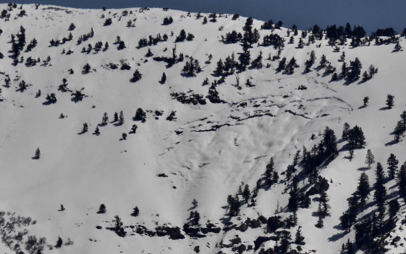
Wet Slabs -
Wet slab avalanches occur when meltwater from rain or warm temperatures percolate down through the snowpack and weaken the bonds (strength) of a buried weak layer. These avalanches can be human-triggered, but also occur naturally, including triggering from a small, wet-loose avalanche or cornice fall. Colder temperatures should lock up the snowpack this morning, but strong sunshine today could provide enough warming to trigger isolated wet slabs. These could occur on any aspect facing west, south, through east, as well as northerly aspects at the low and mid elevations.
2. Cornices - Cornices in some places are massive, and they can break off naturally, especially during warm weather when they start bending downhill. Simply avoid being underneath or near the tops of large cornices as they break farther back than expected.