Forecast for the Ogden Area Mountains

Greg Gagne
Issued by Greg Gagne on
Monday morning, February 25, 2019
The avalanche hazard is MODERATE at the mid and upper elevations for fresh wind drifts. Although any drifts you encounter are likely to be found on aspects facing north through southeast, cross-loading may create drifts on any aspect. Outside of wind-drifted terrain, the hazard is generally Low.
Watch for wet loose activity today in the lower elevations as the cold, dry snowpack may be reactive to today's warmth and cloud cover.
Low
Moderate
Considerable
High
Extreme
Learn how to read the forecast here
Special Announcements
Weather and Snow
Currently: Temperatures in the Ogden mountains range through the 20's F. Westerly winds continue to highlight the weather, with averages in the 20's and 30's mph at the mid and upper elevations, with gusts in the 40's at the upper elevations. A trace to 1" new snow fell overnight.
For Today: Snow showers are possible today, and we'll be lucky to pick up 1-3” of new snow. Skies will be mostly cloudy and temperatures warming into the 30’s. Winds will continue to blow out of the west, averaging in the teens and 20's mph at the mid and upper elevations, with gusts in the 40’s.
For this Coming Week: A mild westerly flow with warm temperatures and windy conditions. We may pick up a trace to 2" of new snow every occasional 12-hour period. Nothing to get excited about. A hint of a promising colder storm late this coming week, but waiting for weather models to come into agreement before we get any confidence in that system.
Excellent riding can still be found at the mid elevations that are sheltered from the wind and sun.
Recent Avalanches
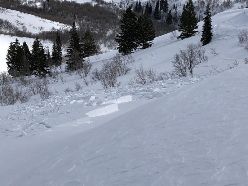
My partner and I encountered 5 avalanches yesterday on our tour in the Ben Lomond region. 3 were natural avalanches, and 2 were intentionally skier-triggered. These were on north and northeast aspects above 7200'. They were 6-18" thick, and the largest natural avalanche ran 250' vertical (photo below).
Summary from UAC avalanche educator Bina Skordas describing our field day yesterday on Ben Lomond (observation).
Ad
Avalanche Problem #1
Wind Drifted Snow
Type
Location
Likelihood
Size
Description
Westerly winds will continue to drift snow at the mid and upper elevations. Although most drifts will be found on leeward aspects facing north through southeast, cross-loading and the winds being channeled through terrain mean drifts may be possible on any aspect at the mid and upper elevations. These drifts will generally be 6-18" thick, and may break out widely in open, exposed terrain, possibly breaking above you.
Video below of an intentionally-triggered avalanche with a ski cut on a steep, mid elevation wind-loaded slope.
Cornices are quite large along upper elevation ridgelines - avoid traveling anywhere near the edge of ridges as cornices may break back much further than expected.
Additional Information
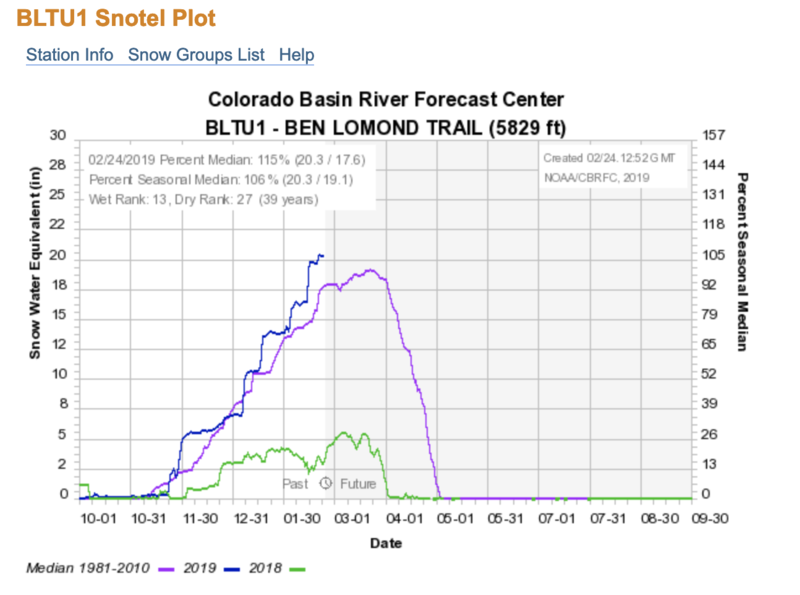
It's been a good run so far this season with many snow stations sitting at 120%+ of average. Below you'll see a screen capture of the Ben Lomond trail snotel site at elevation 5830' in the North Fork. You can find a statewide map here.
General Announcements
This information does not apply to developed ski areas or highways where avalanche control is normally done. This forecast is from the U.S.D.A. Forest Service, which is solely responsible for its content. This forecast describes general avalanche conditions and local variations always occur.