Forecast for the Ogden Area Mountains

Evelyn Lees
Issued by Evelyn Lees on
Thursday morning, February 21, 2019
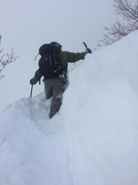
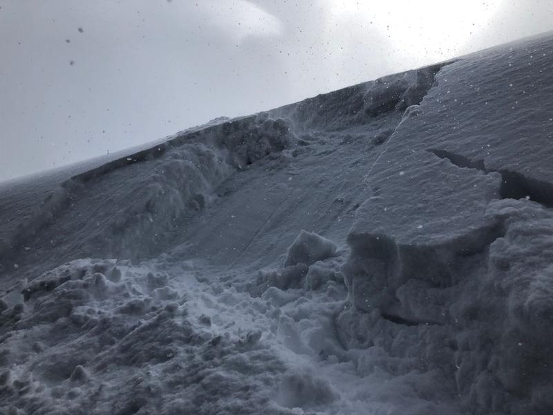
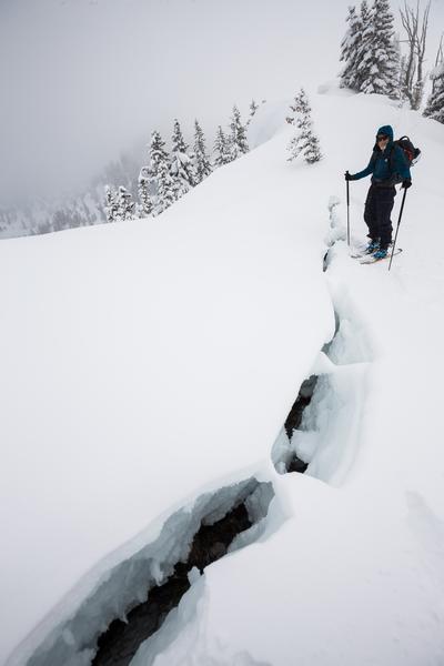
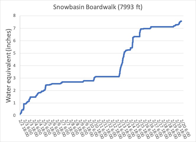
In areas of the Ogden mountains that received more than a foot of new snow, THERE IS A CONSIDERABLE AVALANCHE DANGER on the wind drifted slopes at the upper elevations for triggering a new or old slab of wind drifted snow or a loose snow sluff. Avoid travel on and below the huge cornices. At mid elevations the danger is MODERATE, and the danger is LOW at the low elevations. At these elevations, still identify and avoid wind drifts, including near the canyon mouths, and getting caught in a loose snow sluff.
Other parts of the Ogden area mountains received less snow and have a lower danger today.
Low
Moderate
Considerable
High
Extreme
Learn how to read the forecast here
Special Announcements
The La Sals and the Abajos are about to get hit with another big storm, as are other parts of southern Utah where we don't issue avalanche forecasts, elevating the avalanche danger there, too. An Avalanche Warning has been issued for the Abajos. There are forecasts for the La Sals and Abajos HERE, and we do post obs from the mountains of southwest Utah. View them here or submit obs here.
Weather and Snow
It's been a tale of two worlds, with Snowbasin and Ben Lomond storm totals of about 2 feet of low density snow, while most other parts of the the Ogden area mountains received just 4 to 6" of snow. The 22 inches of snow at Snowbasin was so light it only contained about 1/2 an inch of water. Deep snow and tough trail breaking on Ben Lomond.
The Wasatch will remain on the northern fringe of the storm, with cold temperatures and occasional snow showers producing another inch or two of snow later today, and another few inches tonight. This morning’s temperatures in the Ogden area mountains are in the single digits to around 10 degrees, and will only warm into the low teens to near 20.
Winds shifted to the southeast to northeast and are very light at the mid to upper elevations, averaging 5 to 10 mph, with gusts barely to 20 mph. Canyon mouths like Parleys, Weber, Provo and Ogden have gusts in the 20s, and average speeds are forecast to increase into the 20s today, with gusts in the 30s.
Recent Avalanches
In the backcountry, on Ben Lomond there were several observations of wind drifting, well below 7,000' and test slopes were reactive. Resort control work yesterday in the Ogden area mountains released mainly new snow slides and newer wind drifts. There was one hard slab released on a wind loaded northeasterly facing slope that was 2 feet deep and ran 800 vertical.
Backcountry test slope, Kevin Dressel photo
What's it like to trigger a shallow soft wind slab and escape? It was about 6” deep and 200’ wide, running about 1000’ vertical in Limber Pine, above Little Cottonwood.
Ad
Avalanche Problem #1
Wind Drifted Snow
Type
Location
Likelihood
Size
Description
Wind slabs: Wind speeds are currently light, but there is nothing like easterly winds to keep us on our toes, drifting snow onto unexpected aspects and at lower elevations. In addition to any new wind drifts, there are some lingering soft drifts from the northwesterly winds that can still be triggered at the upper elevations. The best way to avoid these fresh slabs is to look for them and signs of new drifting - watch for plumes off ridge lines and blowing snow where you are, including as you drop in elevation. Wind drifts are often rounded, smooth, and feel denser or thicker than the surrounding snow. Wind speeds may pick up this afternoon and evening.
Sluffing - will continue to be widespread in areas that received a foot or more of new snow. Some of these sluffs will be large enough to catch you off balance and take you for a ride. Some faceting seems to have occurred in recent days within the top of the very low density snow.
Avalanche Problem #2
Cornice
Type
Location
Likelihood
Size
Description
Cornices are HUGE! and breaking back much further than expected. However far you think you need to be back from the edge, take an extra several steps even further back. These yawning cracks may be hidden beneath the newest snow. This is a great photo from the Big Cottonwood ridge line, Silver Fork headwall, Watson, Peterson photo.
Additional Information
So how awesome has February been? One way to see is looking at how much water was contained in the snow. Mark created this graph, and a whole blog with more details HERE.
The accident reports for the four avalanche fatalities are all finalized with some first-hand accounts and worth reading. We all have something to learn so that we can get home safely to our loved ones. List of all accidents found HERE.
General Announcements
This information does not apply to developed ski areas or highways where avalanche control is normally done. This forecast is from the U.S.D.A. Forest Service, which is solely responsible for its content. This forecast describes general avalanche conditions and local variations always occur.