Forecast for the Ogden Area Mountains

Nikki Champion
Issued by Nikki Champion on
Monday morning, February 17, 2020
The avalanche danger is CONSIDERABLE at all upper and mid-elevations elevations and aspects for triggering soft slabs of both new snow and wind drifted snow. Avalanche conditions are dangerous. Human triggered avalanches are likely and natural avalanches are possible.
At low elevations the danger is MODERATE.
Today use careful snowpack evaluation and cautious route-finding.
Low
Moderate
Considerable
High
Extreme
Learn how to read the forecast here
Special Announcements
Discounted lift tickets - Thanks to the generous support of our Utah ski resorts and Ski Utah, all proceeds from these ticket sales go towards paying for avalanche forecasting and education! Get your tickets here.
Weather and Snow
This morning, mountain temperatures are in the upper teens and low-20s F at trailheads, and mid teens F at upper elevations. Winds have dropped off a bit, and are currently west-northwesterly and northwesterly averaging 5-15 mph with mid-elevation gusts of 30-35 mph and upper elevation gusts up to 30 mph. Last night upper elevations gusts hit over 50 mph. It is still lightly snowing.
24-hr storm totals are 8-10" snow (0.80" - 0.90" water)

Today, short periods of snow showers will continue and bring another 2-5 inches of snow before the evening. Mountain temperatures will be in the low to mid-20s F, and winds will continue to west-northwesterly and northwesterly, averaging 10-25 mph, with gusts of 25 to 45 at the highest ridgelines.
Recent Avalanches
Yesterday, ski patrols triggered both shallow soft slabs and loose snow avalanches within the new snow using ski cuts and explosives.
In the backcountry, widespread cracking and avalanches were reported.
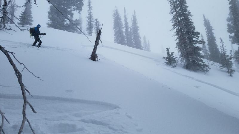
On Cutler Ridge, a skier triggered avalanche was reported on a Northeast aspect at 8300’. This was a soft slab avalanche that failed on a thin layer of facets 8 inches down above the February 7th crust. This avalanche was 100 feet wide and ran 175 feet.

Across the board, these new snow avalanches were shallow soft slabs, 5-8 inches deep. All of these avalanches were easy to trigger and ran far and fast.
Below is a video from the crown of the Cutler Ridge avalanche. See full avalanche summary HERE.
Ad
Avalanche Problem #1
New Snow
Type
Location
Likelihood
Size
Description
Since yesterday, up to 10 inches of new snow has fallen on a variety of bed surfaces on which it can avalanche. In many places the new snow will fracture on a layer of weak, faceted snow just above an ice crust that formed on February 7th. In other places, this layer of facets does not exist but the new snow has not yet bonded with the underlying crusts or other hard surfaces. These crusts and hard layers will allow avalanches today to run long distances today.
Another factor making the new snow unstable is that warm temperatures during the storm yesterday allowed the new snow to form a more cohesive slab. With more snow overnight, these slabs have gotten thicker. Today avalanches to be larger, more cohesive and avalanches easier to trigger than they were yesterday.

Photo of a recent avalanche on Culter Ridge - an obvious sign of instability. (Photo: Joe)
Avalanche Problem #2
Wind Drifted Snow
Type
Location
Likelihood
Size
Description
Overnight winds were strong. Westerly winds hit speeds of 50 mph and should continue to gust up 45 mph throughout the day. The increased westerly winds will be moving enough snow to continue creating fresh wind drifts at the mid and upper elevations, primarily on aspects facing East, but cross-loading is possible on any aspect. These slopes can be loaded from the top of ridges or across the sides of other ridges. Look for obvious signs of wind-drifted snow, and avoid those slopes.

Additionally, these fresh wind drifts will increase the size of our cornices adorning many ridgelines, making them possibly even more sensitive. Stay well back from - and avoid travel below - corniced ridges.
Additional Information
LOOKING BACK:
Before this storm cycle, 2-4” rested on top of a widespread rain/rime crust that formed late Friday, February 7th (The "Dickens Crust"? February 7 is Charles Dicken's birthday and this crust may prove to be the dickens!). The cold temperatures began to weaken, through a process called faceting, the snow both above this layer. In some places a combination of warm daytime temperatures and sunshine healed this layer. In other places this layer survived and has been buried.
The problem with this layer is that many slopes will remain unstable and will easily produce avalanches. Other slopes that do not have this layer will stabilize much more quickly in coming days.
General Announcements
This information does not apply to developed ski areas or highways where avalanche control is normally done. This forecast is from the U.S.D.A. Forest Service, which is solely responsible for its content. This forecast describes general avalanche conditions and local variations always occur.