Forecast for the Ogden Area Mountains

Greg Gagne
Issued by Greg Gagne on
Sunday morning, December 30, 2018
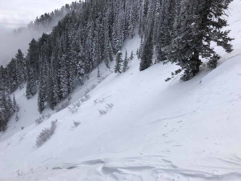
The avalanche hazard will rise to CONSIDERABLE on upper elevation aspects facing north, east, and south as westerly winds increase throughout the day. Upper elevation westerly aspects, as well as all mid elevation aspects, have a MODERATE hazard. The primary avalanche hazard today will be fresh wind slabs, particularly as wind speeds increase in the early afternoon. Also watch for sensitive soft slabs and long-running sluffs in the new snow, especially as snowfall rates increase later this afternoon.
Practice safe travel protocol: Travel one at a time in avalanche terrain, keep your partner in sight and be in position to get to them quickly should there be an avalanche.
Low
Moderate
Considerable
High
Extreme
Learn how to read the forecast here
Special Announcements
The new UAC IOS mobile app is now available on the app store. Check out the new "My Weather" feature.
Weather and Snow
Skies are overcast, and winds are out of the west/southwest, gusting in the teens and 20's mph at mid elevations, and into the 30's at the uppermost elevations. Temperatures this morning in the Ogden mountains are in the low 20's F.
Winds will be out of the west/southwest this morning, shifting to the northwest this afternoon as a cold front moves through the Wasatch range. Wind speeds will be on the increase today, especially by early afternoon. At mid elevations winds will be averaging in the teens and 20's mph, with stronger gusts in the 30's mph; upper elevations will gust into the 40's and 50's. Winds will remain strong through the afternoon, and begin to diminish by about sunset.
Light snowfall is forecasted this morning, with riming possible. Things get interesting by early/mid afternoon when a sharp cold front crashes through the Ogden mountains, followed by a period of a cold, northwest flow! Snowfall rates could reach 2-3"/hour for a short duration later this afternoon, with continued snowfall on a northwest flow into the overnight hours. Snow showers may linger into Monday morning in zones favored by a northwest flow, such as Ben Lomond. The mountains should receive 4-8" of very low-density snowfall by the time this system wraps up.
2018 will conclude - and we'll greet 2019 - with some the coldest temperatures of our young winter season.
Recent Avalanches
No activity reported from the Ogden backcountry. My partner and I were traveling in the Snowbasin backcountry terrain on Saturday, and were finding pockets of old, hard wind slabs from Thursday's east/northeast wind loading events still somewhat reactive. We also were able to get sluffing in the weakening snow surface on steep, shady aspects.
The photo below shows wind-scouring and pockets of fresh drifts in mid-elevation terrain that was exposed to Thursday's east/northeast wind event:
Ad
Avalanche Problem #1
Wind Drifted Snow
Type
Location
Likelihood
Size
Description
Wind slabs formed primarily at the upper elevations during the east/northeast wind loading event Thursday night and early Friday, however on my field day Saturday in the Snowbasin backcountry we were finding pockets of hard wind drifts down to 8000'. Although they were largely unreactive, we were able to still find a few sensitive pockets. Many of these hard wind slabs are sitting on weak, low-density snowfall that fell earlier this past week, and some may still be reactive today. Additionally, today's winds will quickly create fresh wind slabs on all aspects at the mid and upper elevations, especially as winds increase mid-day. These drifts may form on top of weaker snow that currently sits on our snow surface, possibly making them particularly sensitive to a rider.
Although I am not expecting winds to get into low elevation terrain today, watch for changing conditions, especially as the terrain can funnel and channel winds well down into drainages.
Light snowfall is forecasted through much of the day, with the heaviest snowfall expected to begin around 2 pm. Pay careful attention to increasing snowfall rates as the new snow may quickly form sensitive soft slabs and shallow, long-running sluffing in the loose snow.
Additional Information
We will enjoy cold, clear conditions into midweek, with a warm-up and ridging later this week and into the weekend. The models are currently forecasting a warm, moist westerly flow about 7 days out. Right now it may be more of a southern Utah event, but there exists the potential for moisture statewide.
Backcountry Emergencies. (clickable link) It outlines your step-by-step method in the event of a winter backcountry incident.
If you trigger an avalanche in the backcountry, but no one is hurt and you do not need assistance, please notify the nearest ski area dispatch to avoid a needless response by rescue teams. Thanks.
Ogden - Snowbasin Resort Dispatch (801-620-1017), Powder Mountain Dispatch (801-745-3772 x 123)
General Announcements
This information does not apply to developed ski areas or highways where avalanche control is normally done. This forecast is from the U.S.D.A. Forest Service, which is solely responsible for its content. This forecast describes general avalanche conditions and local variations always occur.