Forecast for the Ogden Area Mountains

Drew Hardesty
Issued by Drew Hardesty on
Saturday morning, December 21, 2019
The danger will rise to MODERATE for fresh drifts of wind blown snow. These soft and hard wind drifts will be scattered across the mid and upper elevations and more prominent on north to east facing slopes.
Wet loose sluffs may also be triggered in warm, wind sheltered terrain and may pile up more deeply in terrain traps.
Low
Moderate
Considerable
High
Extreme
Learn how to read the forecast here
Special Announcements
Final report for the Dutch Draw avalanche fatality is available HERE. Consider donating to the Matt Tauszik Memorial Fund to help his wife and young son.

Stocking Stuffers: Thanks to the generous support of our Utah ski resorts and Ski Utah, we have discount lift tickets available. All proceeds from these go towards paying for avalanche forecasting and education! Get your tickets here.
Weather and Snow
Solstice warming aloft.
Southwest winds increasing now;
Relief Christmas Eve?

It's a curious thing to say Happy Solstice while reporting current temperatures in the thermal belt of the mid-elevations in the upper 30s. With a broad, open Pacific trough approaching from the west, winds backed to the west and southwest overnight and are blowing 15-20mph with gusts to 30. The most exposed anemometers along the Ogden skyline (to a southwest flow anyway) are spinning 30-35mph with gusts to 45. We may see gusts to 100mph tomorrow.
Snow surface conditions this morning are a collector's edition of sun and wind crusts with soft settled powder in the wind and sun sheltered terrain.

Our Week in Review - summarizing the significant weather and avalanche events of the past week - can be found here.
Recent Avalanches
A skier triggered a 6" deep and 25' wide hard wind slab yesterday in steep terrain. I expect more soft and hard wind slab development today.
Ad
Avalanche Problem #1
Wind Drifted Snow
Type
Location
Likelihood
Size
Description
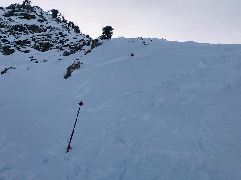
The southwest winds will increasingly scour and erode any available snow and deposit it in the form of scattered and pockety soft and hard wind drifts in the mid and upper elevations. In some areas, these drifts may land on weak snow surfaces formed over the past week and may be surprisingly sensitive. These areas are more likely sun and wind sheltered terrain where the weak snow surfaces are not as susceptible to decay. I wouldn't be surprised to hear that some are triggered at a distance today or tomorrow.
Drifts are often smooth, scalloped, and rounded and are often formed to the lee of terrain features such as ridgelines, sub-ridges, and rocky outcroppings. Soft wind slabs you're "in the snow" with your sled or skis; hard wind slabs you're "on top of the snow". Hard slabs are often trickier because they allow you to get well on to them before the collapse where the wind pillow/teardrop lens shape tapers down.
Cornice drops and ski cutting can be effective techniques in mitigating wind slab avalanches, but they are inherently dangerous and sometimes provide misleading results. A recent paper (with link to a video) on ski cutting by Bruce Jamieson and others can be found HERE. A take-home point - People can be injured and potentially killed while ski cutting.
Danger Trend: Increasing
Additional Information
Snowbasin ski patrol noted a much larger avalanche during last week's storm south of the ski area. Photos below.
General Announcements
This information does not apply to developed ski areas or highways where avalanche control is normally done. This forecast is from the U.S.D.A. Forest Service, which is solely responsible for its content. This forecast describes general avalanche conditions and local variations always occur.