Forecast for the Ogden Area Mountains

Nikki Champion
Issued by Nikki Champion on
Wednesday morning, January 8, 2020
A MODERATE danger exists at mid and upper elevation aspects where fresh slabs of wind drifted snow can be found. These winds will lead to heightened avalanche conditions on specific terrain features and today human triggered avalanches are possible. Be particularly wary around cornices along the ridgelines.
A LOW danger exists on low elevation aspects where generally safe avalanche conditions exist.
Low
Moderate
Considerable
High
Extreme
Learn how to read the forecast here
Special Announcements
Get discount lift tickets HERE. Thanks for this generous support from Utah Ski Resorts and Ski Utah. All proceeds go directly to supporting the UAC.
Weather and Snow
This morning, mountain temperatures are in the mid-30s and low-40s F at trailheads and low to mid-20s F at ridgetops. Winds backed to the southwest yesterday and have blew hard all afternoon and night, averaging between 20-30 mph with gusts near 65 mph along the highest elevations. Even the nid-elevation anemometers had gusts to 45 in the overnight hours.
Today, strong southwest winds will continue into the early morning hours before a quick-hitting storm sweeps through the valley. Winds will then turn northwesterly and decrease as a storm brings 4-6 inches of snow throughout the day. Most of the precipitation will occur mid-morning, but light snowfall could continue into tomorrow morning. Temperatures will be in the upper 20s to low 30s F, and beginning dropping this afternoon.
South-facing aspects will have a firm sun crust this morning, leaving the more desirable riding conditions in northerly terrain that doesn’t have wind damage.
Recent Avalanches
Ski area control work produced little a few more shallow wind slabs. No avalanches reported in the backcountry yesterday.
Ad
Avalanche Problem #1
Wind Drifted Snow
Type
Location
Likelihood
Size
Description
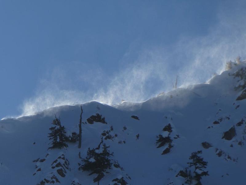
The winds haven't really shut off since the New Years. Yesterday afternoon southwest winds began to pick up and snow was seen pluming off upper ridgetops. Last night into the early morning, gusts at the highest ridgelines were near 65 mph. Expect to see signs of wind drifted snow near ridgelines, on leeward aspects, open bowls, and in cross-loaded features like gullies.
Look for slopes with signs of wind drifted snow and avoid them. They'll be more prominent on aspects with a north or easterly component, but scattered across the compass especially at the mid-elevations.
Photo of wind loading occurring in the Ogden area mountains.
General Announcements
This information does not apply to developed ski areas or highways where avalanche control is normally done. This forecast is from the U.S.D.A. Forest Service, which is solely responsible for its content. This forecast describes general avalanche conditions and local variations always occur.