Forecast for the Ogden Area Mountains

Dave Kelly
Issued by Dave Kelly on
Monday morning, January 9, 2023
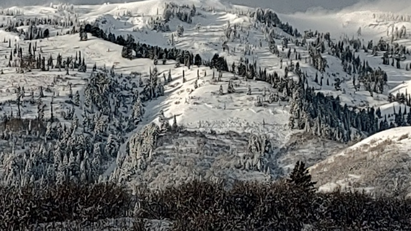
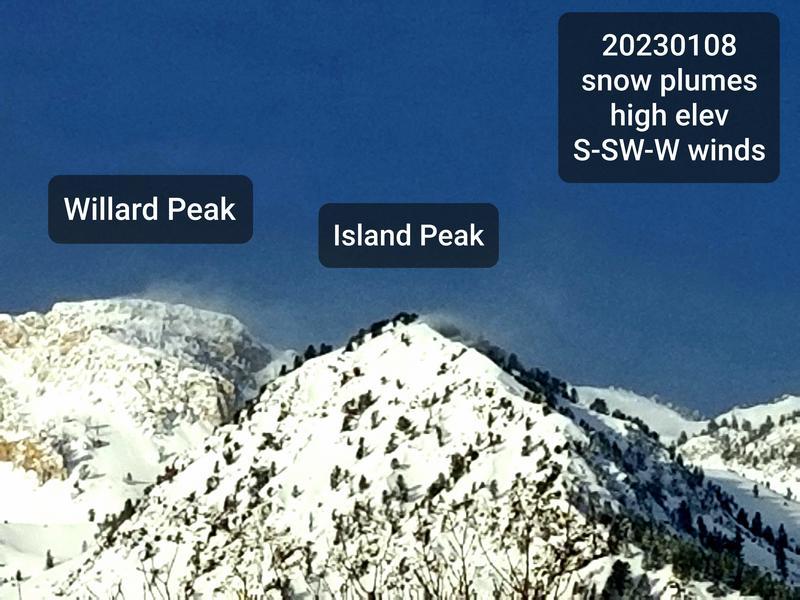
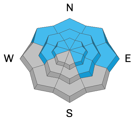
A MODERATE avalanche danger exists on all steep slopes where you may find areas of wind drifted snow. A LOW danger exists at low elevation west-south-southeast aspects.
Human triggered wind-drifted snow avalanches 1-2' deep are possible. In isolated areas you may trigger an avalanche 2-7' deep on the buried persistent weak layer.
Low
Moderate
Considerable
High
Extreme
Learn how to read the forecast here
Weather and Snow
Under clear skies trailhead temperatures are in the mid 20's F while the temperatures at the 9,000' ridgelines are in the low 20's F. Winds are blowing southerly 20 gusting to 40 MPH at the 9000' ridgelines
Today will bring increasing clouds and 2-4" of snow later this afternoon. Temperatures will be 28-33 F. Winds will blow from the southwest 35 gusting to 60 MPH at the 9000' ridgelines. The freezing level will rise from 4,000' to 7,000' during the day.
The National Weather Service has issued a winter weather advisory effective until 5:00pm on Wednesday. This afternoon's southerly flow storm will bring higher density snow before winds shift to the northwest bringing lower density snow Tuesday afternoon through Wednesday.
Recent Avalanches
Yesterday observers reported wind loading off the ridgetops around Ben Lomond. We are still getting excellent reports of the avalanche cycle in the Ogden area mountains from last week.
Photo: K. Davis

Get all the details on yesterday's activity HERE.
Ad
Avalanche Problem #1
Wind Drifted Snow
Type
Location
Likelihood
Size
Description
Soft slabs of wind blown snow will be your primary concern for today. New and developing pillows of wind drifted snow can be found in upper and mid elevation terrain. Watch for cross-loaded slopes on the leeward side of sub-ridges and terrain features.

Observers reported wind-drifted snow 200' off ridgetops- with continued high winds I would expect to see the same today with variable snow surface conditions as the wind has so much snow available for transport. Rounded pillows of snow, shooting cracks, and collapsing of the wind pillows are clues to instability. Watch for sensitive cornices primarily on north-east facing ridgelines where snow has been transported over the last twenty-four hours.

Any wind drifted avalanche may then step down into a deeper buried weak layer resulting in a larger avalanche.
Photo from D. DeBruin of wind loading on ridgetops from yesterday.
Avalanche Problem #2
Persistent Weak Layer
Type
Location
Likelihood
Size
Description
The deeply-buried persistent weak layer (PWL) from November continues to gain strength and it has become harder to initiate an avalanche on this layer. It may take a significant trigger - a large cornice fall, multiple riders on a slope, or another avalanches adding more weight to the snowpack to trigger this layer. Any avalanche triggered on this weak faceted snow would 2-7' deep.

Yesterday we had a report of a close call with this skier triggered avalanche from the Wellsvilles in the Logan area mountains. This is an example of the size of slide we can expect if an avalanche is initiated on the PWL layer in the Ogden area mountains.
Photo: W. Rouse
General Announcements
This information does not apply to developed ski areas or highways where avalanche control is normally done. This forecast is from the U.S.D.A. Forest Service, which is solely responsible for its content. This forecast describes general avalanche conditions and local variations always occur.