Forecast for the Ogden Area Mountains

Mark Staples
Issued by Mark Staples on
Thursday morning, March 5, 2020
The avalanche danger is LOW at all elevations and aspects and conditions are generally safe.
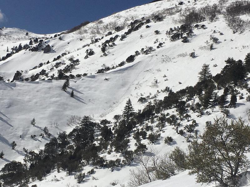
As the day warms up and the snow becomes wet on East, South and then West aspects, loose wet avalanches will become possible but should be predictable.
Although most avalanche activity today should be small, be especially watchful in terrain that can amplify the consequences of a small avalanche.
Low
Moderate
Considerable
High
Extreme
Learn how to read the forecast here
Special Announcements

Thanks to the generous support of our Utah ski resorts and Ski Utah, we have discount lift tickets available. All proceeds from these go towards paying for avalanche forecasting and education! Get your tickets here.
Weather and Snow
This morning temperatures are in the upper 20s and low 30s F and generally about 5 degrees warmer than yesterday morning. Winds increased a bit yesterday afternoon but this morning are blowing 10-15 mph from the southwest.
Today, will have sunny skies and light winds. Temperatures should be a few degrees warmer than yesterday and reach the mid 40s F at 7000 ft. With calmer winds than yesterday, it should feel warmer.
The snow has gotten wet on most slopes except due north facing ones where a few inches of dry snow exists on a hard crust. Despite some air temperatures just above freezing this morning, clear skies overnight should have allowed the snowpack to get a solid refreeze.
Recent Avalanches
Yesterday I spotted one very small and shallow loose wet avalanche at North Ogden Divide that was likely skier triggered. There were no pinwheels or other signs of instability other than one ornery local skier (just kidding Brian ;)
Ad
Avalanche Problem #1
Normal Caution
Type
Location
Likelihood
Size
Description
Avalanche conditions are generally safe but there are a few things to look for.
Wet snow - As the day heats up and the snow gets wet, you should be able to trigger small loose wet avalanches. These usually start at your feet and fan out below you. HOWEVER, watch out for these slides happening naturally especially if you are in a gully or any confined terrain where a small one could pile up deeply.
Wind drifted snow - There is a very small chance you could find a few very shallow soft slabs of wind drifted snow but I think you would have to work to find them.
General Announcements
This information does not apply to developed ski areas or highways where avalanche control is normally done. This forecast is from the U.S.D.A. Forest Service, which is solely responsible for its content. This forecast describes general avalanche conditions and local variations always occur.