Forecast for the Ogden Area Mountains

Mark Staples
Issued by Mark Staples on
Saturday morning, April 6, 2019
Today the avalanche danger is MODERATE. The main issue will be wet avalanches at mid and low elevations where the snowpack was wet and saturated yesterday. The mostly likely avalanches will be wet loose slides at mid and low elevations, but wet slabs will be possible at mid elevations. At upper elevations, shallow avalanches of wind drifted snow will be possible.
Low
Moderate
Considerable
High
Extreme
Learn how to read the forecast here
Special Announcements
Summer is a busy time for the UAC working on our fall and winter planning, putting together the Fall Fundraiser and the Utah Snow and Avalanche Workshop (USAW), and updating our education programs. In addition, this summer we will be finishing up the website redesign project. Your donation shows you’re invested in this community all year round! You can still be part of the UAC’s success in 2019.
Consider making a donation by April 8. Thank you!
Weather and Snow
Currently: Precipitation started yesterday with rain transitioning to snow early this morning above 8000 feet. As of 6 a.m. 1-2 inches of snow (0.3-0.4 inches of water) has fallen at upper elevations. Mountain temperatures at lower elevations this morning are in the upper 30s F. At upper elevations temperatures are in the upper 20s F. Westerly winds at ridgetops are averging 5-10 mph gusting 15-30 mph. They were gusty at low elevations as well.
Today: Snow and rain will continue through the morning with rain below 7500 feet. By mid day most precipitation will taper off and end tonight as dry air enters the area through the weekend. Another 2-3 inches of snow could accumulate today. Winds today will continue from the west at similar speeds.
Next week: A very promising storm is on schedule for Tuesday night into Wednesday. It will bring cold air and some snow to the valley by Wednesday morning with a decent amount of snow in the mountains.
Recent Avalanches
The snowpack in the Ogden area is very wet and had a poor refreeze Thursday night, and yesterday it was saturated and unsupportable at low elevations. On Ben Lomond Peak an observer spotted many small wet loose avalanches yesterday.
Ad
Avalanche Problem #1
Wet Snow
Type
Location
Likelihood
Size
Description
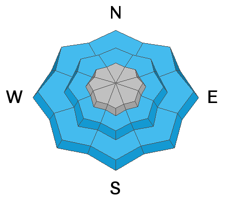
The main avalanche problem to look for will be wet avalanches. These will be most likely at low and mid elevations where rain falling on the snow will cause loose wet avalanches. The main thing to do is avoid being under steep slopes.
As you climb higher into mid elevations there will be a transition zone where some rain fell followed by a little snow. Both wet loose and shallow wet slab avalanches are possible.
Avalanche Problem #2
Wind Drifted Snow
Type
Location
Likelihood
Size
Description
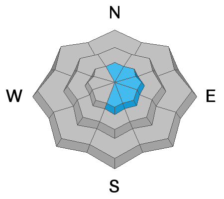
As you climb higher and find dry snow, watch for shallow wind drifts from westerly winds this morning.
Persistent Weak Layer - Although a different avalanche problem, there is a two-week old buried weak layer of facets and surface hoar. It existed on northerly and easterly facing slopes about 2-3 feet deep. It's hard not to mention this layer which could possibly produce a larger and deeper slab avalanche. This layer seems to be healing and there haven't been recent avalanches on it in over a week and a half.
General Announcements
This information does not apply to developed ski areas or highways where avalanche control is normally done. This forecast is from the U.S.D.A. Forest Service, which is solely responsible for its content. This forecast describes general avalanche conditions and local variations always occur.