Forecast for the Provo Area Mountains

Mark Staples
Issued by Mark Staples on
Wednesday morning, February 27, 2019
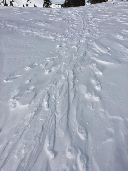
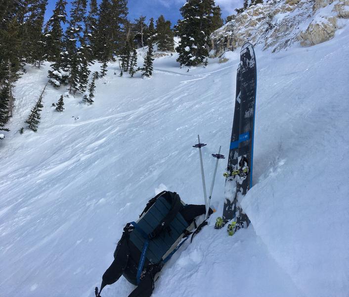
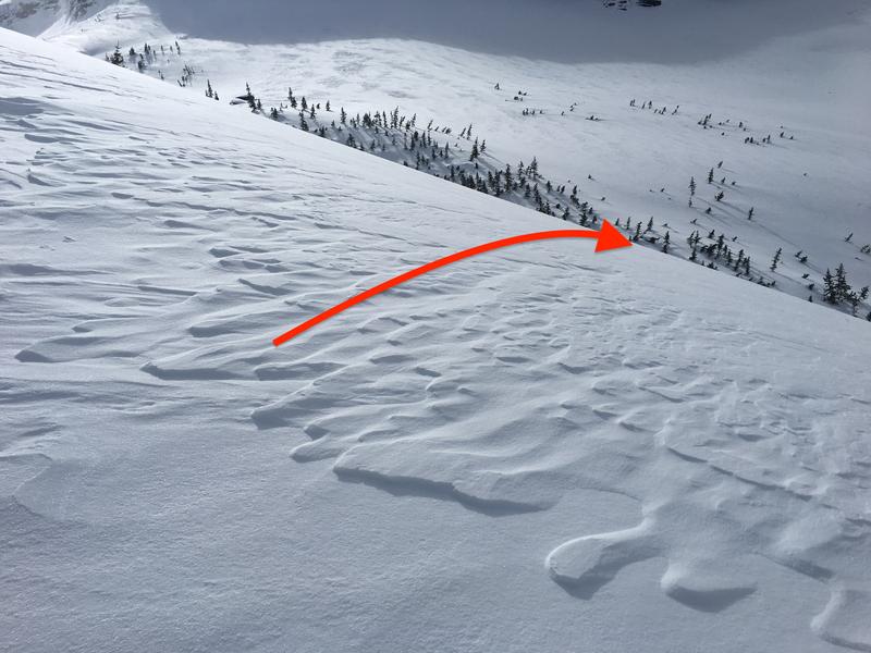
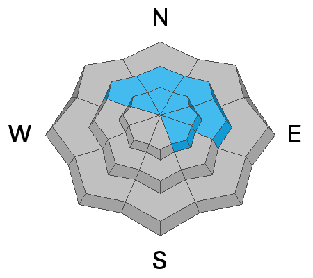
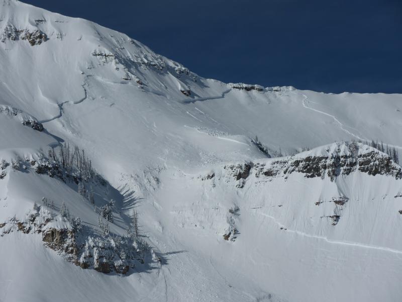
Today the avalanche danger is MODERATE at all elevations. There are a few different avalanche problems. Slabs of wind drifted snow exist mostly at upper elevations. Wet avalanches of loose snow are possible at low elevations due to warm temps and possibly a touch of rain. Big avalanches breaking on a persistent weak layer near the ground are unlikely, but would break so big that it's hard not to consider them as well.
Low
Moderate
Considerable
High
Extreme
Learn how to read the forecast here
Special Announcements
Weather and Snow
Currently:
Temperatures are near freezing at 8000 feet and near 40 degrees F at 7000 feet.
Strong southerly winds continued overnight and are blowing 25 mph gusting 40 mph this morning. At 11,000 feet gusts are reaching 60-80 mph.
These winds have damaged the riding quality on many slopes. At lower elevations the snow has become wet from warm temps.
For Today:
Strong southerly winds will continue and temps should warm into the 40s F near 8000 feet. An inch or two of snow could fall today with a touch of rain below 7000 feet.
Photo below shows inverted ski tracks which is a sign of wind scouring the soft snow around those tracks. Soft, dry powder is becoming elusive, but possible to find on wind-sheltered slopes above 8000 feet.
Recent Avalanches
Yesterday a snowboarder in Big Cottonwood Canyon triggered a soft slab of wind drifted snow. I expect similar avalanches could be triggered in the Provo area mountains.
Ad
Avalanche Problem #1
Wind Drifted Snow
Type
Location
Likelihood
Size
Description
The main avalanche issues to watch out for are slabs of wind drifted snow. Winds don't have much snow left to transport, but they were still moving small amounts of snow yesterday. This avalanche problem can be tricky as some drifts and slabs stabilize while others remain unstable. Also with such strong winds, many of these slabs could be quite hard meaning they will let a person get further onto them before they break. Joey Dempster sent this great observation from yesterday.
These wind slabs are best to identify visually as they look smooth, rounded, pillowly, etc and typically exists adjacent to slopes that have been scoured. The photo below is a great example of scouring and with the arrow showing where you'd expect to find a fresh slab that could avalanche. They should be mostly a concern at upper elevations.
Cornices are quite large, and continue to grow during this windy period. Avoid traveling underneath cornices, as well as anywhere near the edge of ridges as cornices may break back much further than expected. Although now a few days old, it is worth reading this excellent observation from Sunday (link) where the author cautions "Please, stay back from the edge! Even further than you think."
Avalanche Problem #2
Wet Snow
Type
Location
Likelihood
Size
Description
Watch for small sluffs of wet snow at mostly at low elevations but possibly at mid elevations as well. The surface snow at low elevations is likely wet this morning. Warming temperatures and a chance of some rain below 7000 feet could make this avalanche problem become more likely as the day progresses.
Avalanche Problem #3
Persistent Weak Layer
Type
Location
Likelihood
Size
Description
Assessing the snowpack in the Provo area mountains in avalanche terrain at mid and upper elevations on NW, N, NE, E aspects (and upper elevation SE) is difficult. Recent natural avalanches have broken at the ground in the Provo mountains, and control work on Sunday at a Cottonwood resort in the Salt Lake mountains produced a slide breaking down 3-4' deep in facets at the ground . Although it is hard to assess the likelihood of triggering one of these avalanches, the consequences of getting involved in one is likely deadly. The only mitigation strategy we have is to avoid avalanche terrain for now.
Photo: Zoomed in view of the natural avalanche that was spotted last week.
General Announcements
This information does not apply to developed ski areas or highways where avalanche control is normally done. This forecast is from the U.S.D.A. Forest Service, which is solely responsible for its content. This forecast describes general avalanche conditions and local variations always occur.