Forecast for the Ogden Area Mountains

Drew Hardesty
Issued by Drew Hardesty on
Monday morning, March 2, 2020
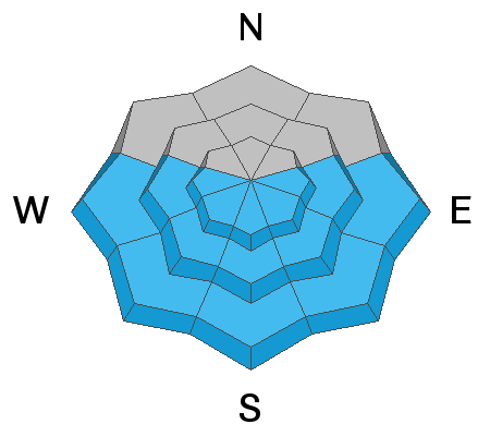
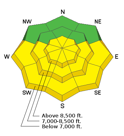
The danger will rise to Moderate for wet avalanches on the steep sunlight terrain today. Natural and human triggered wet loose avalanches are probable. Isolated pockets of lingering shallow new snow avalanches are also possible in steep terrain, primarily in the upper elevations.
Low
Moderate
Considerable
High
Extreme
Learn how to read the forecast here
Special Announcements
The UAC's Avy Awareness Auction is currently underway with tons of great gear, jewelry, artwork and experiences available. Visit the auction page HERE to help support the UAC's spring avalanche awareness and outreach efforts.

A new version of the UAC IOS application is now available on the Apple App Store. This version fixes many of the issues that occur when running IOS 13. Download it now!
Weather and Snow
Skies are mostly clear this morning with generally light winds from the northwest. Along the highest elevations of the Ogden skyline, winds are blowing 20mph with gusts to 25. Temperatures are in the teens.
Storm totals are 3-4" of about 6-7% density and even these few inches will dramatically improve skiing and riding conditions.

For today, we'll have clear skies, light northwest wind and temperatures warming to the mid to low 20s. We'll probably see a few clouds tonight into tomorrow with a weak system pushing through but then a return to sunny skies by mid to late week. Possible storm for next weekend; stay tuned.
Recent Avalanches
Ski area control teams triggered 3-5" new snow avalanches running on the old crusts yesterday.
Ad
Avalanche Problem #1
Wet Snow
Type
Location
Likelihood
Size
Description
Wet loose avalanches can be expected with direct sun and daytime warming. Natural and human triggered wet sluffs are likely on the steeper slopes and should leave decent debris piles, running far on the slick underlying crusts. When the snow becomes damp and/or you start to see rollerballs and pinwheels, it's time to head to a cooler aspect or low angle terrain. These wet sluffs generally move slowly, but they pile up like concrete. Don't take them for granted.
Avalanche Problem #2
New Snow
Type
Location
Likelihood
Size
Description
Shallow sluffs and soft slab avalanches may still be possible in the highest elevations. Remember that the new snow may run fast and far on the slick underlying crusts. These are manageable for experienced riders but the debris piles may be enough to bury a person beneath continuously steep terrain.
General Announcements
This information does not apply to developed ski areas or highways where avalanche control is normally done. This forecast is from the U.S.D.A. Forest Service, which is solely responsible for its content. This forecast describes general avalanche conditions and local variations always occur.