Forecast for the Ogden Area Mountains

Drew Hardesty
Issued by Drew Hardesty on
Sunday morning, January 24, 2021
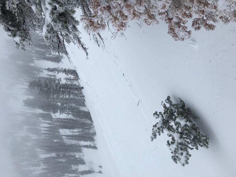
TODAY HAS ACCIDENT WRITTEN ALL OVER IT.
THE DANGER FOR TODAY IS CONSIDERABLE. Most avalanche accidents and fatalities occur at this danger rating.
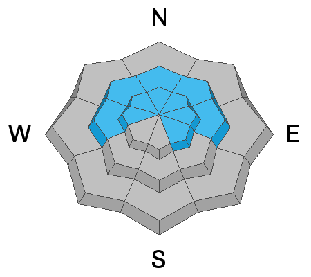
Human triggered avalanches are likely on many steep slopes at the mid and upper elevations. They are possible at the low elevations.
LOW ANGLE TERRAIN IS YOUR BEST AND SAFEST OPTION TODAY.

If you're leaving a resort boundary through an exit point, you are stepping into CONSIDERABLE avalanche danger.
Low
Moderate
Considerable
High
Extreme
Learn how to read the forecast here
Special Announcements
SPECIAL NOTE:
HALF OF ALL SKIER/SNOWBOARDER FATALITIES SINCE 99/00 HAVE OCCURRED WITH PEOPLE GOING OUT OF BOUNDS AT A SKI AREA.
Weather and Snow
Skies are overcast with light snow falling across the range.
Winds are light from the southwest. Mountain temperatures are in the teens.
Storm totals so far are 12-20" with 1.10 to 1.70" snow water equivalent.
Skies should trend mostly and perhaps partly cloudy today with mountain temps still cool in the teens. Winds will remain light from the southwest.
The Outlook:
Another storm arrives but dives well south of us for the first part of the week. Another storm sets up mid week well to the west of us that will pummel us by strong southwest winds. It eventually ejects inland and moves overhead Friday into the weekend.
Recent Avalanches
We heard about four human triggered avalanches in the Ben Lomond area yesterday. Most of these were in the Cutler Ridge area with one perhaps near the Rodeo Ridge area. These were generally 12-14" deep and up to 150' wide on northeast to east facing slopes from 6900'-8300' in elevation. At least one avalanche was triggered at a distance and another was triggered sympathetically from an initial slide. Some photos below.
NOTE THAT SOME OF THESE SLOPES "LOOK' BENIGN...AND YET THEY AVALANCHED. Another long time observer noted that one of these slopes he had never seen run before.
Ad
Avalanche Problem #1
New Snow
Type
Location
Likelihood
Size
Description
New snow avalanches may still be triggered on all aspects and elevations. Some of these may be up to 1-2' deep today. These avalanches may be particularly sensitive on steep west to north to east facing slopes, even in the low elevation bands. One might even trigger them at a distance. The snow surfaces prior to the storm were particularly weak with what we call near surface facets...along with carpets of surface hoar (the wintertime equivalent of dew).
Avalanche Problem #2
Persistent Weak Layer
Type
Location
Likelihood
Size
Description
This was a significant loading event to test the reactivity of our older buried weak layers from November. These avalanches certainly loom as deep and destructive and this terrain should be avoided for now. Any new snow avalanche may step down into this older layering 2-4' deep.
General Announcements
Please visit this website with information about Responsible Winter Recreation by the Utah Office of Outdoor Recreation.

This information does not apply to developed ski areas or highways where avalanche control is normally done. This forecast is from the U.S.D.A. Forest Service, which is solely responsible for its content. This forecast describes general avalanche conditions and local variations always occur.